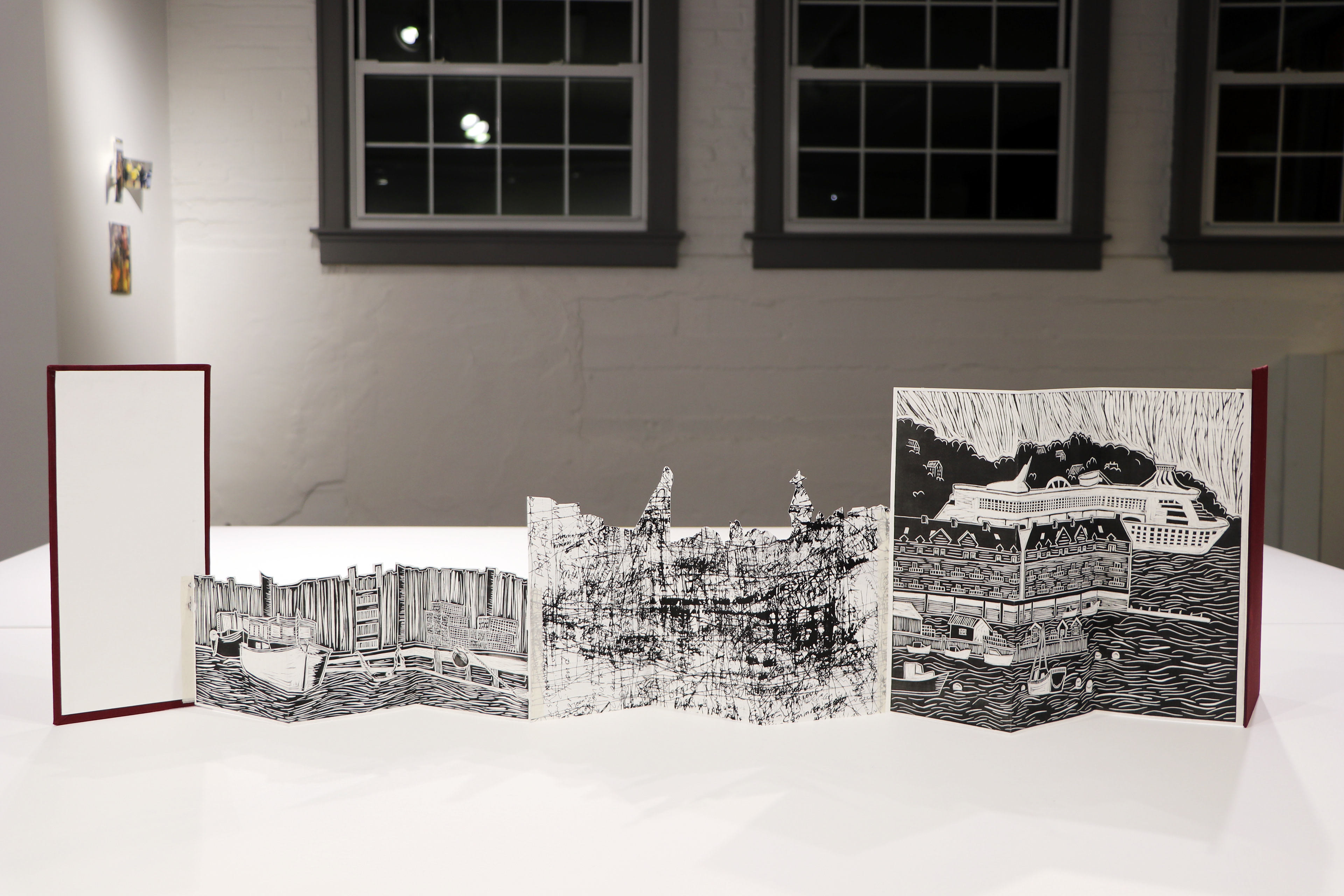
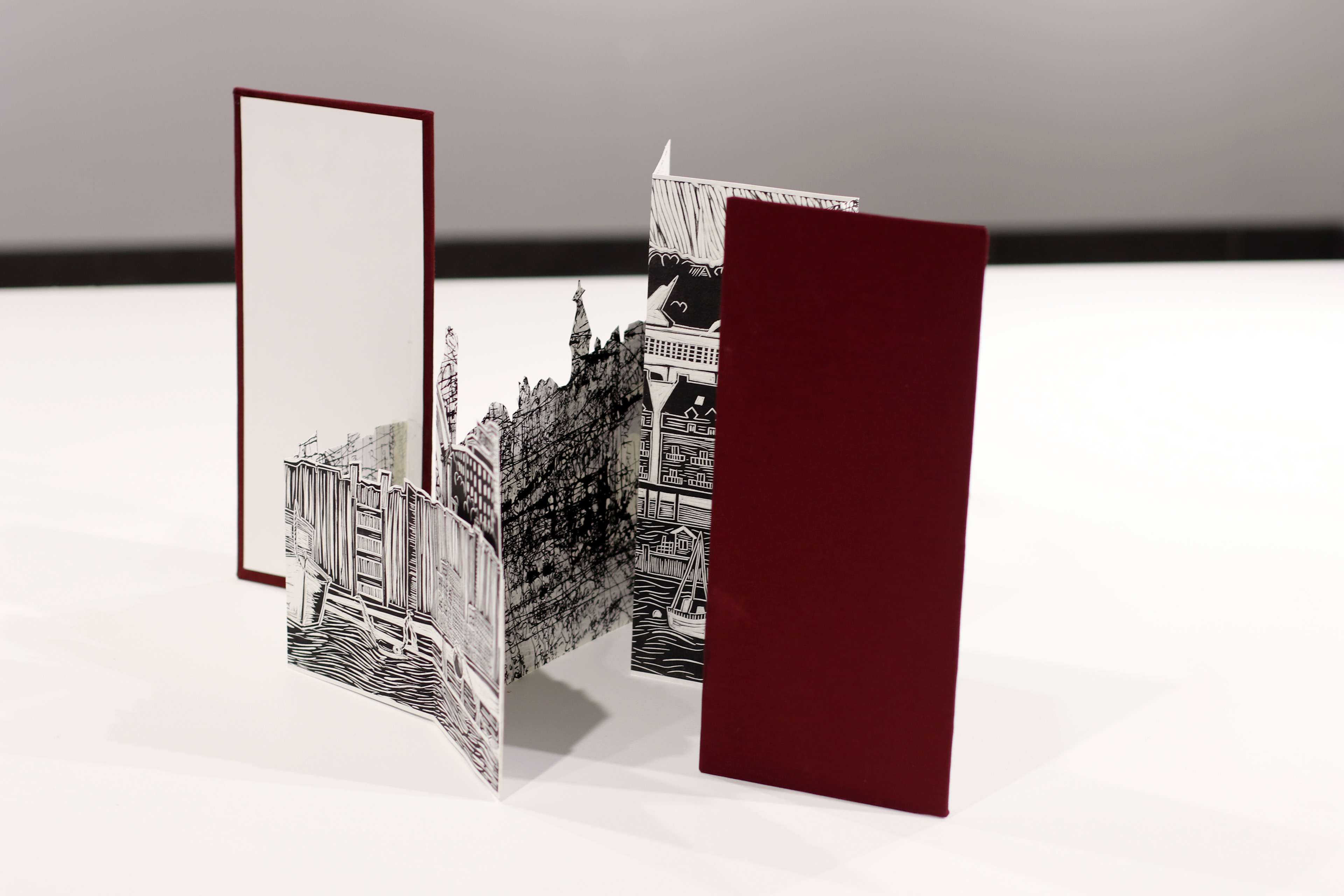
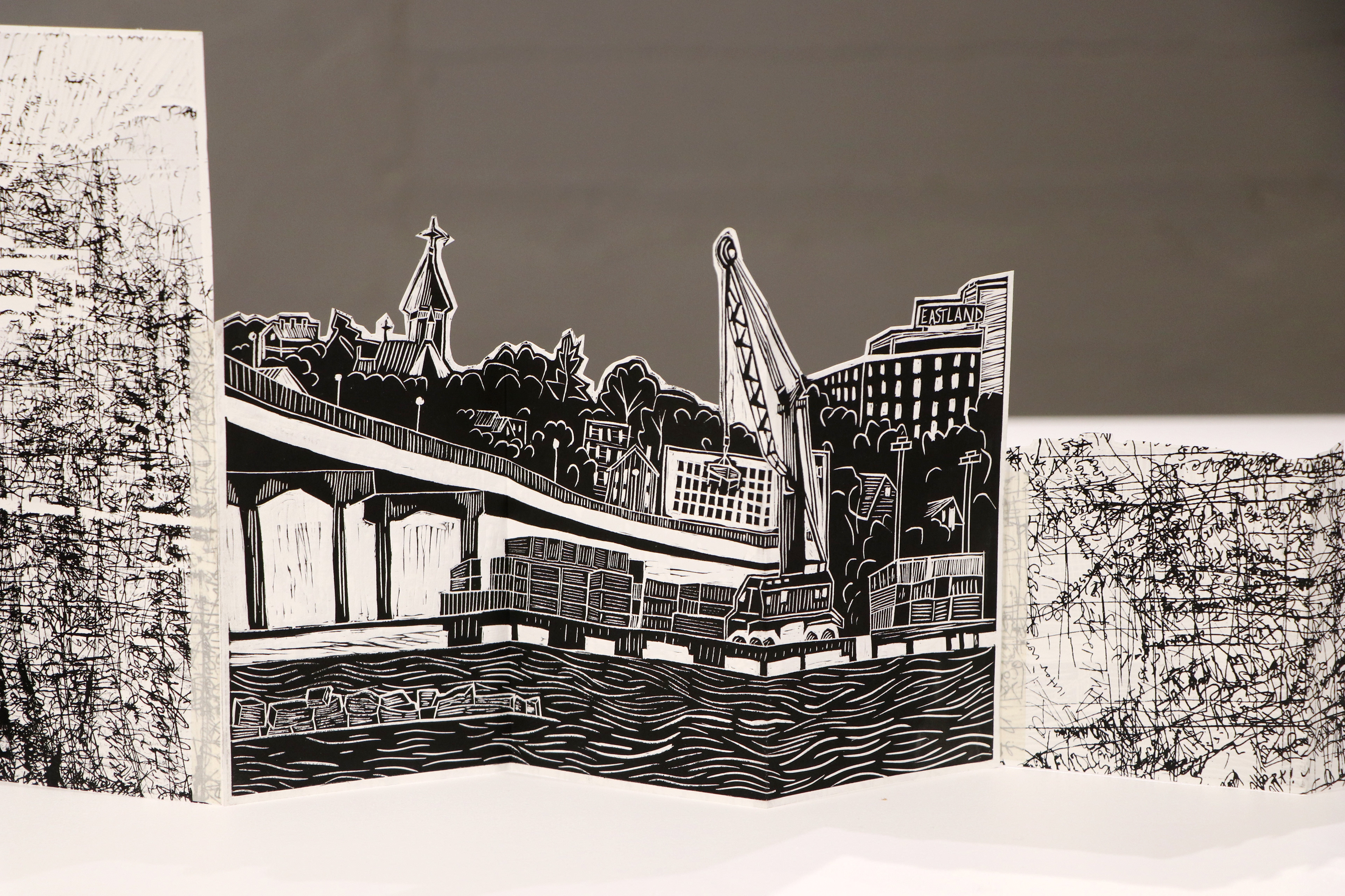
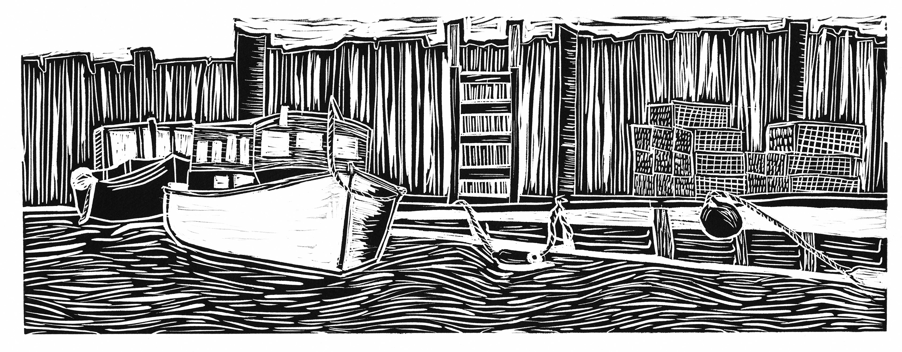
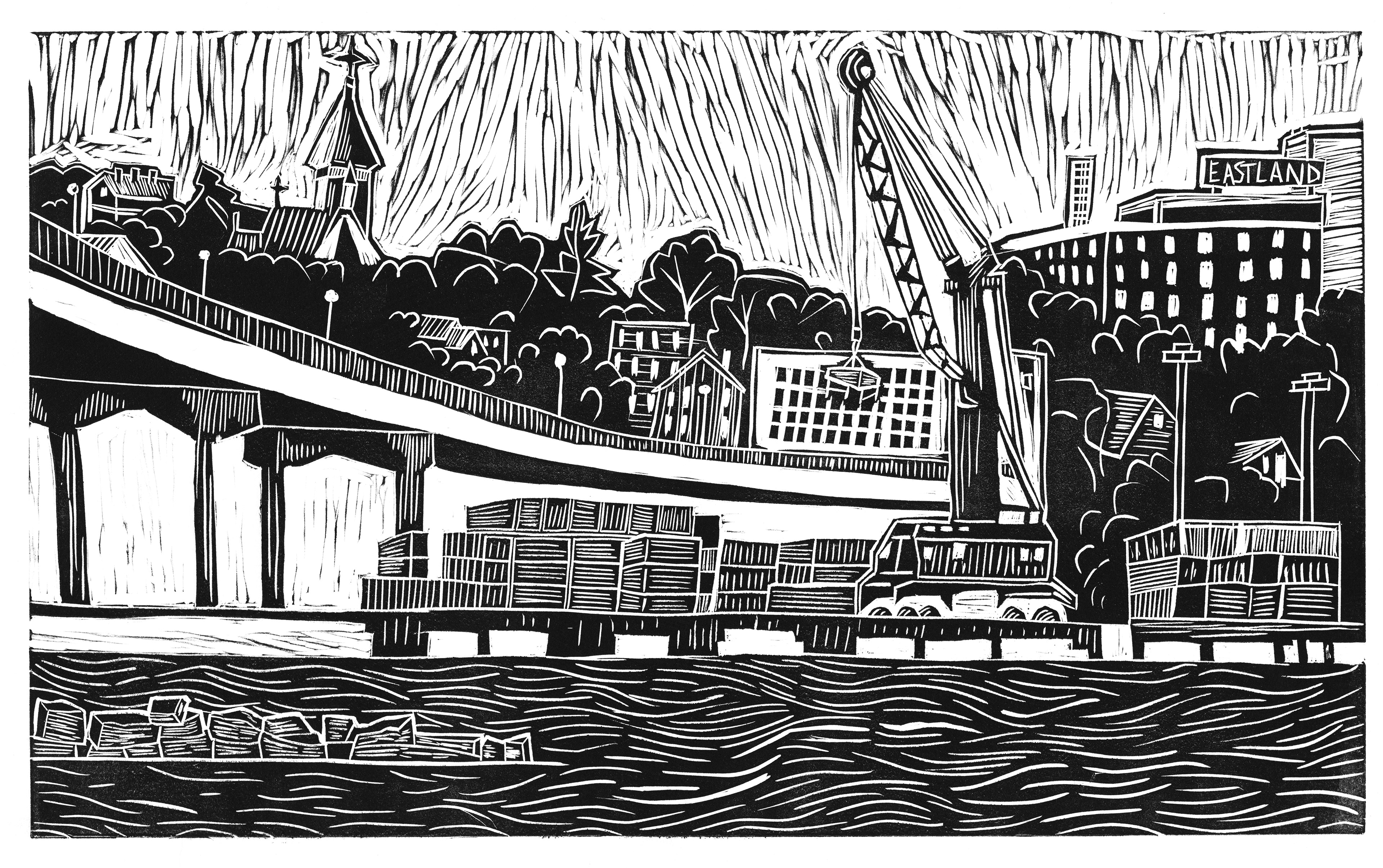
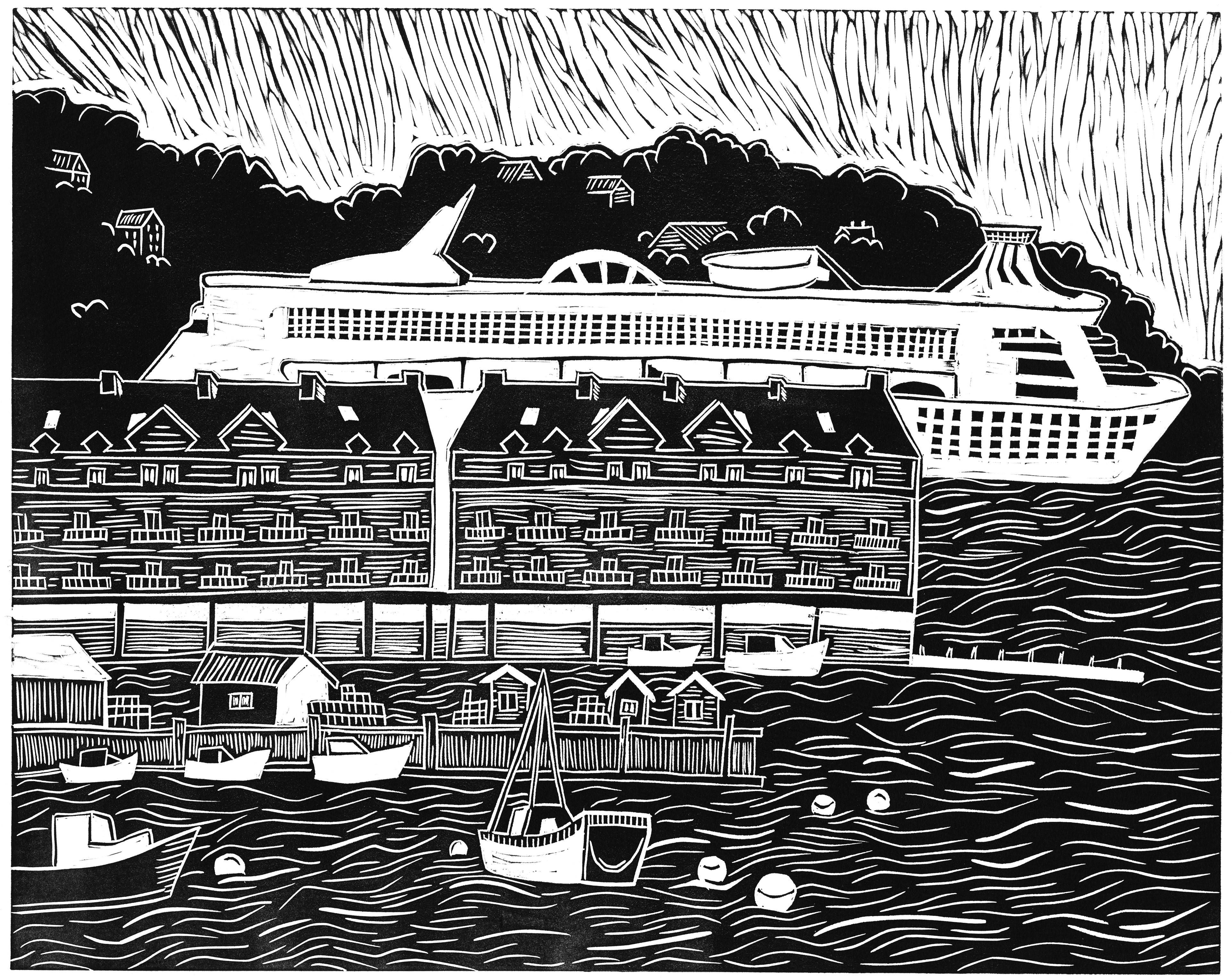
Based on a year of research along the Portland waterfront, this series illustrates my narrative of the layers within the Portland harbor: lobster traps on wooden piers, stacks of containers for mechanized trade, and a newly emerged tourist-driven coast of cruise ships and shoreside apartments.
Accompanying the blocks is a silkscreen of layered "mental maps," hand-drawn maps of Portland's waterfront made by two dozen people who work on or are deeply invested in Portland's identity. The artist book aims to show the multiple identities of this imagined space in conversation with each other.
Linocut on Rives BFK (4x18", 6 x18", 10x18")
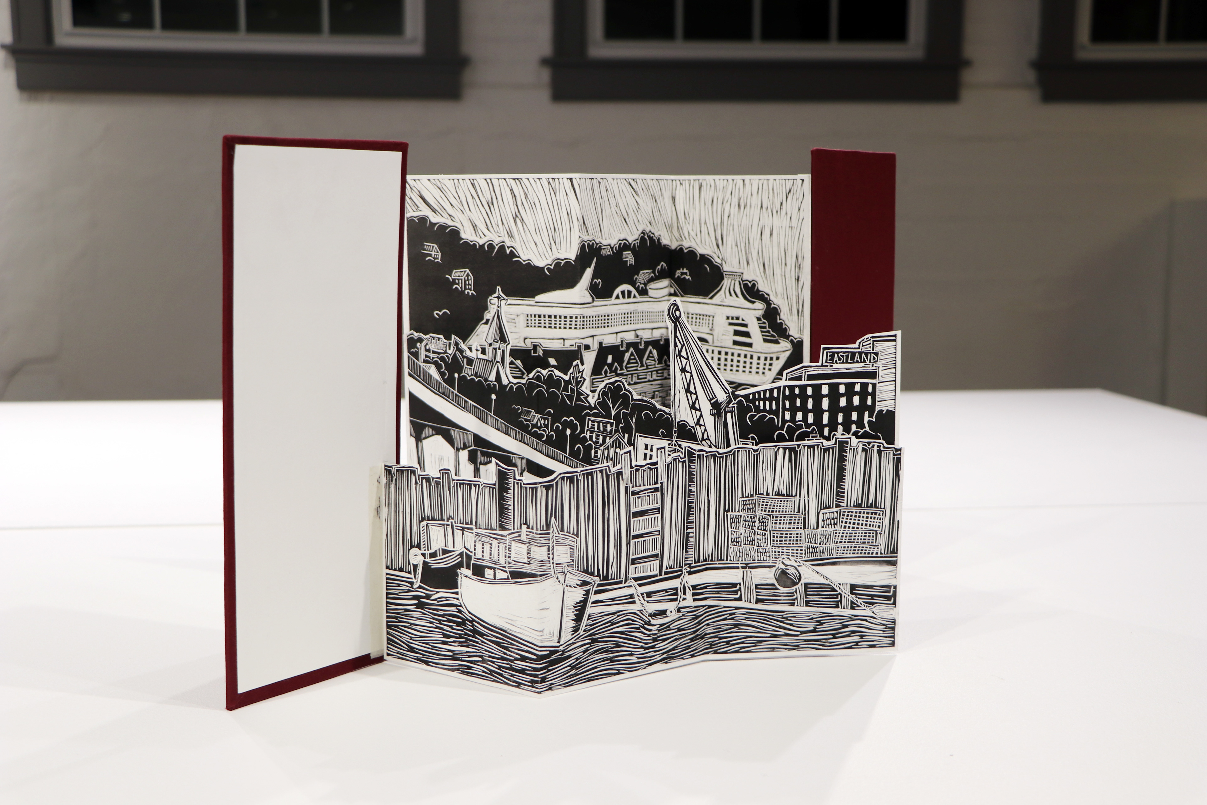
Imagined Waterfront (book board, linen, linocut).

Digital compilation of maps hand drawn by 24 Portland residents throughout interviews I conducted. Every interviewee was prompted to draw "the Portland waterfront," whether it be past, present, changes they hope to see or changes over time.